Difference between revisions of "Yellow Island"
| Line 6: | Line 6: | ||
The toponyms of various physical features were standardized in the [[Tapfer Continental Organization and Standardization Treaty]]. | The toponyms of various physical features were standardized in the [[Tapfer Continental Organization and Standardization Treaty]]. | ||
| − | <gallery> | + | <gallery mode=packed-overlay> |
| − | File:Yellow Island Physical.png| | + | File:Yellow Island Physical.png|Physical features. |
| − | File:Yellow Island Terrain.png| | + | File:Yellow Island Terrain.png|Terrain map. |
| − | File:Yellow Island Resources.png| | + | File:Yellow Island Resources.png|Resource map. |
</gallery> | </gallery> | ||
[[Category:Natopia]] | [[Category:Natopia]] | ||
Revision as of 21:41, 4 February 2017
Yellow Island is the large island located northeast of the main continent of Tapfer. It has also been known as Tapfer Minor before the term Yellow Island was standardized by Natopia. Yellow Island is named for the Yellow Territory, a subdivision of Menelmacar which occupied most of the island except for the Elivian Peninsula. The minor outlying islands, Crystal Island, Augustus, Micronia, Ferien,Ptia, and the Juzur Al-Akhawat Isles are often associated with Yellow Island.
Most of Yellow Island is occupied by the Natopian demesne of Flaventia, which takes its name from the Latin word for yellow, flavum. The Natopian capital, Lindstrom is on Yellow Island but is a special Imperial territory. Crystal Island is occupied by Alrodey and Augustus is part of Arboria.
The toponyms of various physical features were standardized in the Tapfer Continental Organization and Standardization Treaty.
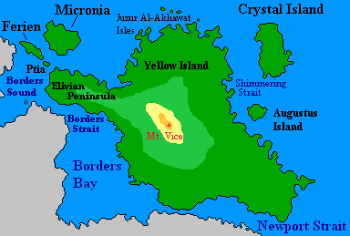
Physical features.
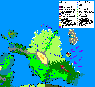
Terrain map.
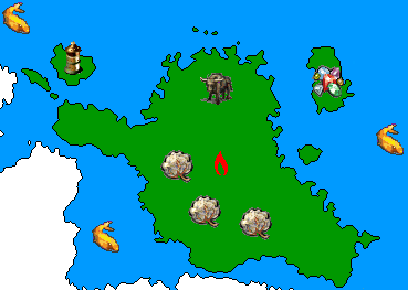
Resource map.


