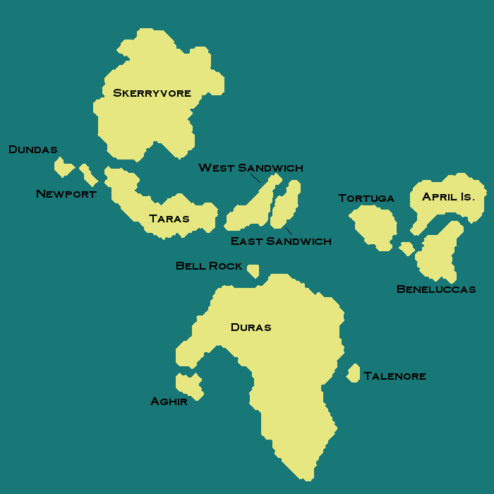
Skerry Isles
Skerry Isles
| Area | ??? km² |
|---|---|
| Population | 4 |
| Countries | 5 |
| Dependencies | 0 |
| Languages | New Brittanic, Nova English |
| Largest Cities | Lighthouse Pharos |
The Skerry Isles, also called the Skerries, are a collection of fourteen islands close to the equator of Micras. It is bounded on the northeast by Keltia, Lyrica Island to the northwest, and Eura to the south.
Origin and Etymology
The term skerry is derived from Old Stormarkian sker, which means a rock in the sea. Although much bigger than a mere rock, the term skerries began to be applied to the area as fishermen plied the waters from Lyrica, Keltia and surrounding inhabited continents. It is assumed that the name originally referred to the many rocky islets that dot the surrounding seas. Eventually the term became more broadly applied to encompass all the islands.
Geography
The two largest islands are Skerryvore and Duras, followed by Taras, April Island and Tortuga, respectively. East and West Sandwich along with Beneluccas follow. Lesser islands include Talenore, Aghir, Dundas, Newport and Bell Rock.
