File:Amity- physcial- PNG.png
From ShireWiki
Jump to navigationJump to search
No higher resolution available.
Amity-_physcial-_PNG.png (598 × 413 pixels, file size: 19 KB, MIME type: image/png)
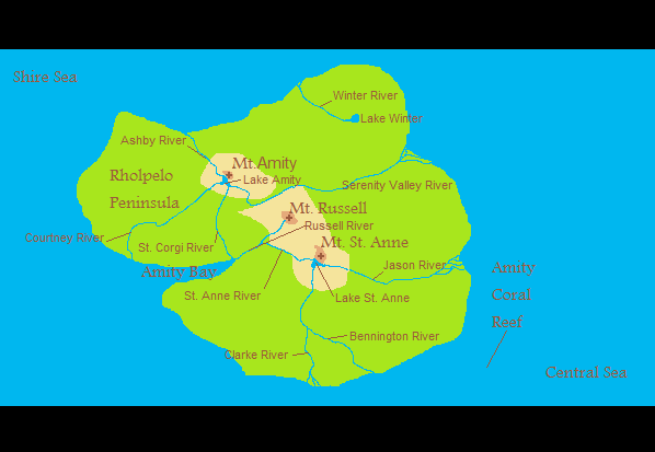
Physical Map of Amity Isle
File history
Click on a date/time to view the file as it appeared at that time.
| Date/Time | Thumbnail | Dimensions | User | Comment | |
|---|---|---|---|---|---|
| current | 00:29, 26 February 2010 | | 598 × 413 (19 KB) | Gman russell (talk | contribs) | Physical Map of Amity Isle |
You cannot overwrite this file.
File usage
The following page uses this file: