File:Wintergleam.png: Difference between revisions
From ShireWiki
Jump to navigationJump to search
(A political map of the great families of Wintergleam.) |
No edit summary |
||
| Line 1: | Line 1: | ||
A political map of the great families of Wintergleam. | A political map of the great families of Wintergleam. | ||
[[category:Maps]][[category:Historical]][[category:States]] | |||
Latest revision as of 02:53, 19 August 2017
A political map of the great families of Wintergleam.
File history
Click on a date/time to view the file as it appeared at that time.
| Date/Time | Thumbnail | Dimensions | User | Comment | |
|---|---|---|---|---|---|
| current | 04:16, 21 November 2009 | 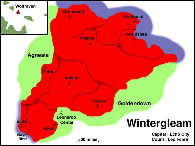 | 640 × 480 (111 KB) | Leo (talk | contribs) | A political map of the great families of Wintergleam. |
You cannot overwrite this file.
File usage
The following file is a duplicate of this file (more details):
There are no pages that use this file.